Difference between revisions of "Tyne Cot Cemetery"
(Created page with "{{TOCright}} '''Tyne Cot''' <ref>[http://maps.google.nl/maps/ms?ie=UTF8&hl=nl&msa=0&msid=106873382516269114910.000466501f9883292ec07&ll=50.886683,2.999879&spn=0.005069,0.01028...") |
m (→See also) |
||
| Line 13: | Line 13: | ||
* [http://www.flickr.com/search/?q=Tyne%20cot&w=all Flickr photos] of Tyne Cot. | * [http://www.flickr.com/search/?q=Tyne%20cot&w=all Flickr photos] of Tyne Cot. | ||
* [[WW1_Locations]] shows mappings of the various WW1 locations. | * [[WW1_Locations]] shows mappings of the various WW1 locations. | ||
| + | |||
| + | http://farm1.staticflickr.com/41/86141345_c943485d97_z.jpg | ||
| + | | ||
| + | http://farm1.staticflickr.com/39/86141323_c465bef23a_z.jpg | ||
== Reference == | == Reference == | ||
Latest revision as of 18:21, 7 November 2012
Contents |
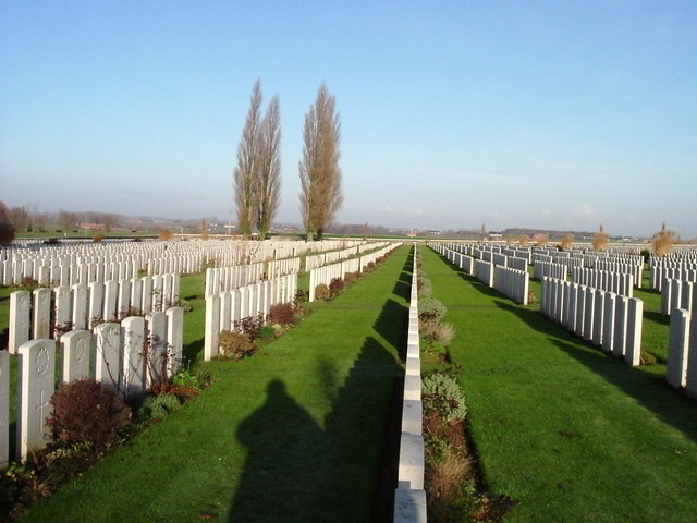
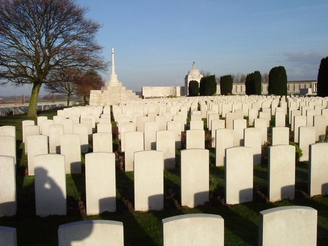
Tyne Cot [1] is the largest Commonwealth cemetery of the English forces in world. The name "Tyne Cot" seems to come from the resemblance between the German pill boxes and a Tynesite workers cottage.
WW1
Thursday 4 October 1917 is the crucial day of the Battle of Passendale. The starting-point of the attack was the road Zonnebeke-Langemark. On the evening the 3rd Australian Division lay on the place of the current cemetery.
The battle terrain is intersected by an old railroad Ieper - Roeselare, since 1952 out of order. The province of Flanders wants to create a new walking- and bicycle road between the Memorial Museum Passchendaele and the Tyne Cot Cemetery.
Archeology
Before making this road an extended archeologic research investigation has been made, resulting
See also
- Flickr photos of Tyne Cot.
- WW1_Locations shows mappings of the various WW1 locations.
Reference
- ↑ Google Maps, Location of Tyne Cot. Since November 2009 the images of th terrain are much better!